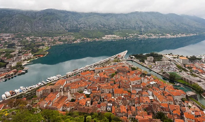
The Bay of Kotor, also known as Boka Kotorska (Boka Bay) is one of the most beautiful geographical singularities in Montenegro. Named the southernmost fjord in Europe, Boka Bay is in fact an ancient submerged canyon, eroded by the Bokelj River, protected by the high mountains of the Dinaric Alps (Orjen to the west, and Lovcen to the east) that hide from the sea the friendly bay a World Heritage Site.
 |
| Bay of Kotor |
The bay's climate is benign in winter, protected from the cold that plagues the interior of Montenegro, thanks to the mountainous barrier that surrounds it, and which encourages fauna such as palm trees, agaves, mimosas, or medicinal herbs to survive in the winter months to bloom in spring.
 |
| Bay of Kotor |
A place of first-rate strategic interest during the Venetian domination of the Adriatic, the Bay of Kotor served as a refuge in case of storm and Ottoman attacks, something that did not go unnoticed by the Austro-Hungarian Empire, which had its most important naval base here, reused by Tito during the time of belonging to Yugoslavia.
 |
| Bay of Kotor |
The most important places of interest are the towns of Herceg Novi, Risan, Perast, Kotor, and Tivat, each with its attractions that range from the mixed oriental and Byzantine architecture of Herceg Novi, through the mosaics of the Roman patrician house. by Risan; to the walled city of Kotor, a defensive bastion against the Ottoman incursions, or to Tivat, which with its airport has become the main air entrance to Montenegro, giving rise to Porto Montenegro, a luxury yacht mooring port unparalleled in the Mediterranean, and which is already well established within nautical tourism. On the other hand, religious tourism also attracts many believers, pilgrims, or art lovers who come to see one of the more than 300 Catholic and Orthodox churches, temples, and hermitages, scattered throughout the bay.
 |
| Bay of Kotor |
The good weather of the Bay of Kotor, with several sunny days overwhelming other parts of the Adriatic, has intensified the reputation of the Montenegrin coast.
 |
| Bay of Kotor |
Although the extension between the entrance of the bay and the furthest inland point is barely 28 km, the coastline winds its way for more than 100 km, which makes driving around it somewhat tedious. To solve part of the route there is a barge in Kamenari that crosses to the other end in the Strait of Verige (the narrowest point of the bay, with 340 meters), saving part of the coastal loop.
 |
| Bay of Kotor |
One of the best ways to see the immensity of the Bay of Kotor is from the sea, enjoying a boat excursion, which goes through other interesting points such as the island of Our Lady of the Rocks, the Island of Mamula, or the Blue Cave.
