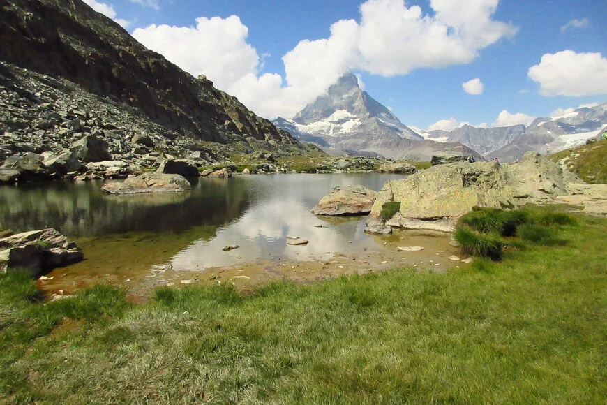
The Matterhorn is located in the Pennine Alps, on the border of Italy and Switzerland. This mountain is the symbol of Switzerland. The peak is distinguished by a decent height of over 4,000 meters and a very special pyramidal shape, which makes it very dangerous to climb. Because of this, he was one of the last to be conquered. Despite this, in the Alps, the Matterhorn is a fairly popular destination among climbers. Every year people try their hand, risk their lives, try to climb the peak and conquer it. The Matterhorn has a nickname - the killer mountain. It is so called because of the large number of victims who tried to reach the top.
 |
| Matterhorn Mountain Switzerland |
Where is the Coordinates
The Matterhorn Mountain is located in the Pennine Alps at an altitude of 4478 m above sea level. The peak occupies the territory of Switzerland, the Valais canton, and Italy, the Valle d'Aosta province. The coordinates of the mountain are as follows:
- 45 ° 58 '35 "(45 ° 58' 58) north latitude
- 7 ° 39 '29 "(7 ° 39' 49) East Longitude
The nearest settlement is the village of Zermatt, located at the northern wall of the peak. At the southern wall there is a settlement of Breuil-Cervinia, which belongs to Italy.
 |
| Matterhorn Mountain Switzerland |
Switzerland and Italy are separated by the picturesque region of the Valle d'Aosta province, on the border of which the Penin Alps rise. Many tourists go ships for the unforgettable scenery of high snow-capped peaks or go skiing, but only a few of them dare to climb the top of the Alps.
One of the most popular mountains is not the highest. Its German name is Matterhorn, and the Italian name is Monte Cervino. It attracts tourists with its unusual appearance, reminiscent of a pyramid deployed in four cardinal directions. The peak is located near a small lake and stands apart from the rest of the hills.
The height of the Matterhorn mountain is 4478 meters above sea level.
The first measurement was carried out in 1792 using a long chain. In fact, the Matterhorn has two peaks of approximately the same height. By decision of both countries, their location was clearly fixed on the common border.
 |
| Matterhorn Mountain Switzerland |
Climbing
The nearest settlements from the Matterhorn mountain are Zermatt (Switzerland) and Breuil-Cervinia (Italy). Interestingly, they used to be small, unremarkable villages, but after conquering the top they began to gain popularity among tourists.
As a rule, if a climber comes to Zermatt, then the ascent goes along the Hearnley ridge, thus repeating the ascent of the pioneers. If to the Italian Breuil-Cervinia, then along the Lyon ridge. The second option is considered more difficult and is suitable for trained athletes.
 |
| Matterhorn Mountain Switzerland |
The slopes of the peak are steep, so ice and snow do not linger on them. This is a great danger for a person climbing it. Many avalanches fall down during the year, taking with them everything that comes their way. Also for this reason, there are four glaciers on the lower level, located on all sides of the mountain. Some of the largest are Tifmatten and Matterhorn at the western and northern walls.
The ascent along the classic track to the Swiss summit begins at an altitude of 3260 meters from the Hearnley shelter. The round trip takes about 12 hours. On the steepest sections, there are struts with stretched ropes. Around the middle of the route there is another shelter for a group of up to 10 people with a walkie-talkie for emergency calls.
You can also visit the foot of the Matterhorn in a less extreme way, using the mountain railway or lifts.