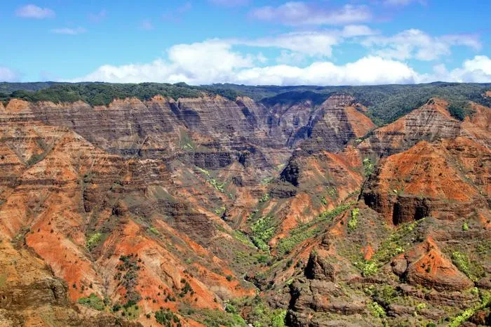
Despite being 16km long, 1.6km wide and more than 1,000m deep, the most impressive thing about Waimea Canyon (the largest in the Pacific) is not the measurements, but the colors! The deep scars on the canyon walls, carved by rivers flowing down from the wet summit of Waialeale Mountain, glisten in the sunlight in a rich color palette. Emerald green folds and rugged dark cliffs descend into reddish rivers. On clear days (morning is the best time) you can see waterfalls and the rainbow on the volcanic rock.
 |
| Waimea Canyon |
In the west of the Hawaiian island of Kauai, there is the largest canyon in the Pacific region - Waimea Canyon. It is so large that it is often compared to the famous Grand Canyon!
Waimea Canyon Road is road number 550. There is an equipped observation deck, and there are platforms along the road, made by tourists, where you can park your car and go out to see and photograph the canyon.
 |
| Waimea Canyon |
Geologically, the canyon is a complex rupture of volcanic basalt inundations; its structure suggests that in the past the island was in an extremely unstable tectonic zone and was regularly subjected to the destructive impact of the movement of the earth's crust plates. The western and eastern sides of the canyon are separated by an incredible rift into which, it is assumed, a large part of the island once sank.
The canyon was created not only as a result of years of erosion, but also thanks to the incredible eruption of the volcano that once created Kauai.
 |
| Waimea Canyon |
Waimea Canyon was formed in Mount Waialeale. This is the result of the Waimea River flooding and rainwater flows that gradually washed away the lava fallows. Under the influence of the wind, over time, the basalt acquired a bright red color.
The Waimea Canyon area is a large nature park that is a protected area.
 |
| Waimea Canyon |
In addition to the canyon itself, the park includes a large part of the unspoiled wilderness of the island - many visitors to Waimea enjoy hiking there. Local foresters monitor the order and safety of tourists; at their station anyone can get a detailed map of the park's walking routes.
