Cameron Highlands (Malaysia) from A to Z: map, hotels, attractions, restaurants, entertainment. Shopping, Photos and reviews about Cameron Highlands.
 |
| Cameron Highlands Malaysia |
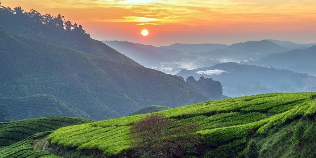
Located in north-central Malaysia is the Cameron Highlands, located at an altitude of 1100 m to 1700 m high with temperatures of 15 ° C to about 28 ° C.
In this area we will find large tea plantations that are scattered throughout the valley and the tourist guide is around the colonial history, we will also find memories in the form of strawberries.
 |
| Cameron Highlands Malaysia |
In Cameron Highlands we can come across butterfly farms, large strawberry plantations and see rafflesia, the largest flower in the world.
What to do in Cameron Highlands
The most common thing to do in this area is trekking, which has several routes. The map of these destination sites to explore, we can find them in the hotels, in these maps everything is well identified and the trekking routes are listed. The routes for trekking are around 14, among which we can find for example:
- On route number 1: we will see a hard ascent due to frequent rains, with muddy areas, however it is an incredible experience through the jungle. Reaching the second highest peak at about 2000 meters high, and overlooking the tea plantations.
- Routes 2 and 3: are usually combined since they cross each other, and are a bit difficult to find at the beginning; these are near a golf course.
- Route 4: is perfect for initial trekking, this route in some places is a bit narrow and slippery. The tour takes about 15 min we will find two paths with hanging bridges that reach the Parit waterfalls.
- In route 5: as in some routes it is a bit difficult to find the beginning, and at the end of the route is the Gunung Berembun peak.
- Route 6: is one of the most difficult, since it has some places covered by vegetation. This route goes under the electricity towers, in some places it has ropes to lower down since when it rains the path becomes very slippery.
- On Route 7: the first 300 meters is a little covered by vegetation; at the end of this is the Gunung Beremban peak.
- On route 8: begins the Robinso falls and in the same way as on route 7 we arrive at Gunung Beremban peak.
- On Route 9: and 9A it is not recommended for safety, it is best to ask the owner at the accommodation for information about it.
- On route 10: we can reach Gunung Jasa peak.
- Routes 11 and 12 and 13: are almost totally covered by vegetation
- Route 14: continues after Route 1 passing Gunung Brinchang al Gunung iran peak which is the highest in the Cameron Highlands.
 |
| Cameron Highlands Malaysia |
One of the tourist attractions is the Sam Poh, which is a series of well preserved golden warrior temples in history. We will also find a Hindu temple of today, in the same way there is the Time Tunnel museum which shows us the history of this area.
Weather in Cameron Highlands
The climate in Cameron Highlands is quite cool, the mountainous terrain keeps the air temperature no higher than + 20-22 degrees. The monsoon season lasts from November to February, the dry season from February to April. Moreover, the coldest time of the year is from December to February, when the temperature reaches only 10 degrees.
 |
| Cameron Highlands Malaysia |
How to get there
Cameron Highlands is a very popular destination, with buses from almost all parts of the country constantly running here. It takes two hours to get from Tapah to Cameron Highlands by bus, which runs regularly from 8:00 to 18:00. Alternatively, you can get here by taxi. From the capital of the country, Kuala Lumpur, the bus takes about 5 hours. You will have to pay for a taxi from 380 MYR. From Penang, the bus takes 6.5 hours.