The Paraná River, a river in South America, the second longest after the Amazon, rises from the plateau of southeastern Brazil and generally flows south to the point where, after a journey of 3,032 miles (4,880 km), it it joins the Uruguay River to form the extensive estuary of the Atlantic Ocean in the Río de la Plata.
 |
| Parana River |
The Paraná River drainage basin, with an area of approximately 1,081,000 square miles (2,800,000 square km), includes most of southeastern Brazil, Paraguay, southeastern Bolivia, and northern Argentina.
From its source at the junction of the Grande and Paranaíba rivers to its confluence with the Paraguay river, the river is known as the Alto (Alto) Paraná. This upper basin has three important rivers, which are, the Tiete, the Paranapanema and the Iguazú, all three have their sources near the Atlantic coast in the southeast of Brazil.
 |
| Parana River |
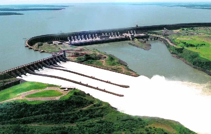
The passage of Alto Paraná through the mountains was previously marked by the Guaíra Falls; This series of massive waterfalls was completely submerged in the early 1980s by the reservoir of the recently built Itaipú hydroelectric complex, which stretches across the Alto Paraná.
There are 2 large rivers on the map of South America - the Amazon and the Parana. The first place is occupied by the Amazon, the second is the Parana River. The article provides a description of the Parana River, its geographical position, and some features.
 |
| Parana River |
Location
The beginning of the river is considered to be the confluence of the Rio Grande and Paranaiba rivers with coordinates 20 ° S, 51 ° W. The sources of the rivers are located on the Brazilian Highlands, the mouth on the Atlantic coast of the Laplat Lowland. The coordinates of the mouth 34 ° S, 58 ° W.
Parana flows through the territory of Brazil, Argentina, Paraguay.
