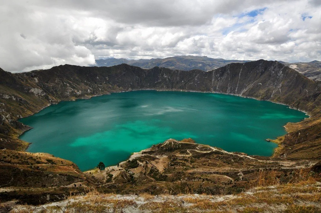
Quilotoa (Laguna de Quilotoa) is a cone-shaped volcano in Ecuador with a height of 3914 meters above sea level. Located on the border of the Eastern Cordillera, 35 kilometers northwest of the city of Latacunga. In the center of the volcano there is a crater about 3 kilometers in diameter and filled with a lake 250 meters deep. Quilotoa is the westernmost volcano in the Ecuadorian Andes.
 |
| Quilotoa |
Eruptions
The last confirmed volcanic eruption dates back to 1280. Data on the time of the eruption were obtained by radiocarbon analysis. The eruption had a Volcanic Explosivity Index (VEI) of 6. Lava flows reached the Pacific Ocean. During the eruption, about 18 km³ of magma was ejected in 4 phases. The eruption created a caldera. Ash from the volcanic eruption covered an area of 37,000 km², with a thickness ranging from 75 centimeters near the volcano to 1 centimeter in remote areas. After this eruption, presumably, several more occurred, but the data on them are contradictory. Geological studies have shown that over the past 200,000 years there have been at least 8 eruptions of the Quilotoa volcano.
 |
| Quilotoa |
Tourists
The Quilotoa Lake is becoming more and more popular with tourists every year, who are attracted by the opportunity to see something menacing, but beautiful.
 |
| Quilotoa |
The road to the crater lies through the village of the same name, where buses with tourists regularly come and where you can stay at the hotel. The distance from the top of the crater to the Quilotoa lake is 400 meters, offering a beautiful view. But visitors are invited not only to look at the lake from above, but to go down and ride a canoe, which can be rented for $5. It is recommended to visit the crater in the morning to avoid the time when the lake is covered with fog.