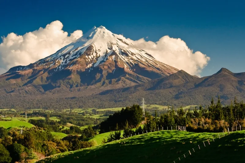
Mount Taranaki, also known as Mount Egmont, is located on the west coast of New Zealand.
Mount Taranaki less commonly known as Mount Egmont, is a dormant stratovolcano in the Taranaki region on the west coast of New Zealand 's North Island. It is the second highest point on the North Island after Mount Ruapehu. The 2,518 meters (8,261 ft) high mountain has a secondary cone, Fantams Peak (Maori : Panitahi), 1,966 meters (6,450 ft) high, on the south side.
 |
| Mount Taranaki |
Volcanic Activity
Taranaki is geologically young, having started its activities approximately 135,000 years ago. The most recent volcanic activity was the formation of a lava dome in the crater and its collapse down the mountainside in the 1850s or 1860s. Between 1755 and 1800, an eruption sent a pyroclastic flow down the northeast side of the mountain, and a moderate ash eruption occurred around 1755, the size of Ruapehu 's activity in 1995/1996. The last major eruption occurred around 1655. Recent studies have shown that over the past 9,000 years, small eruptions have occurred on average about every 90 years, and large eruptions every 500 years.
 |
| Mount Taranaki |
Taranaki is unusual in that it has survived at least five major cone-collapse eruptions. Few volcanoes have experienced more than one cone collapse. The vast volume of material involved in these collapses is reflected in the vast annular plain surrounding the volcano. There is also evidence that lahars are a common result of an eruption.
Much of the region is under threat from lahars that have reached the coast. For a lahar, a volcanic event is not necessary: even earthquakes, combined with heavy rain or snow, can displace a huge amount of unstable layers lying on steep slopes. Many farmers live in the way of such possible devastating events.
 |
| Mount Taranaki |
Although volcanic eruptions are known to be erratic in their frequency, some scientists warn that a major eruption is "overdue". Massey University research suggests that significant seismic activity could again occur in the next 50 years. The prevailing winds are likely to blow ash to the east, covering much of the North Island and disrupting airways, power lines and local water supplies.
