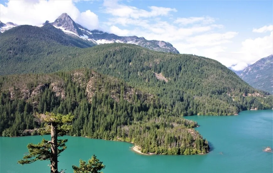
North Cascades National Park is located in the northwestern region of the United States, in the state of Washington.
 |
| North Cascades National Park |
The park is located in the northern part of the Cascade Mountains (Cascade Range) - a large mountain range in the west of North America, stretching from the Canadian province of British Columbia, through the US states of Washington and Oregon, to northern California. There are about 20 large volcanoes on the territory of the Cascade Mountains (12 of them rise to a height of more than 3000 m above sea level, including active ones), and non-volcanic mountains, and this ridge is part of the Pacific Ring of Fire. The Cascades are home to four national parks (Map 2, highlighted in red): Lassen Volcanic, Crater Lake, Mount Rainier, and the North Cascades, as well as several national monuments.
North Cascades National Park consists of two relatively autonomous parts, north and south, separated from each other by the Skagit River, along with the adjacent Ross Lake National Recreation Area.
The Northern Cascades NP consists almost entirely of wilderness areas (wilderness), and accordingly, in the park itself there are no lodges, no motels, no shops, no gas stations, no paved roads. External communication with the park is via State Route 20 (or North Cascades Highway), which runs in these places parallel to the Skagit River between the northern and southern sections of the park.
 |
| North Cascades National Park |
We arrived along this road from the western side of the park and, without entering its territory, in the town of Marblemount we turned south onto Cascade River Road. This way we could get to the beginning of our first trail in the park called the Cascade Pass trail. Most of this road is not paved, the final section of the road enters the territory of the Northern Cascades Park. The 37 km journey from the Marble Mountain to the place where this route begins takes almost an hour.
Cascade Pass trail is one of the most popular day trails in this park. Its length is 6 km one way, the climb is 550 meters. A significant part of the path zigzags through the forest. Only when we rose above the level of the forest did we discover wonderful views of the numerous glaciers, sunlit mountains and valleys.
There are a lot of flat stones on the pass itself, so here is a favorite place for tourists to stop and have a snack. And the views from here are mesmerizing, which you want to admire. In one direction - the basin of Mount Pelton (Pelton Basin), which opened only from this pass, along which you can go further into the Stehekin River valley. In the opposite direction - an excellent view of the Eldorado Peak, 2703 m high, with the glacier of the same name (Eldorado Peak).
The Cascade Pass has long been used by people to pass through the local mountains. At first they were Indians, and from the beginning of the 19th century, Europeans. Probably the first "white-faced" who passed this route in 1811 was the fur trader Alexander Ross, a Scot by birth. Since the middle of the 19th century, several expeditions have visited these places in search of potential routes for roads (the railway was never built here due to the complexity of the terrain, and the highway was launched only in 1972). In the late 19th and early 20th centuries, prospectors came here to mine gold and silver, but this region did not become a Klondike.
 |
| North Cascades National Park |
Now on the pass there is a large number of ground squirrels spoiled by tourists. The squirrels are so accustomed to easy-to-get food that they now seem to think it's the tourists' responsibility to share treats with them.
Several new trails start from the pass - down into the valley or further up - towards the Sahale Peak. After resting, we decided to continue climbing the Sahale Arm Trail and walked along it for about 1 km (out of 3.5 km possible, to the tent city). Perhaps this part of the path was the most difficult: rocky and steep, but also the most picturesque, probably. It was already a zone of subalpine meadows covered with flowers, with amazing views of the surrounding mountains, glaciers and an emerald mountain lake, whose name can be translated as Doubtful Lake.
The next day is "unloading" after a rather difficult hike the day before. We spend it moving along the road number 20, making frequent stops for photographs. This area is not part of the Northern Cascades proper, but belongs to the Ross Lake National Recreation Area, marked in yellow on Map 3. The Skagit River flows here, on which three dams were built, resulting in three artificial reservoirs - Ross Lake, Diablo Lake and Gorge Lake. Gorge Dam was the first to be built in the 1920s.
