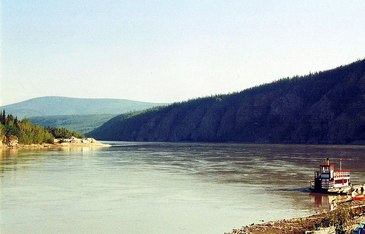
The Yukon is a river in northwestern Canada and the United States that flows into the Bering Sea. The length of the river is 3190 km, the area of the drainage basin is 832.7 thousand km². The annual runoff is 202.7 km³.
 |
| Yukon River |
Etymology
The word "Yukon" in the language of the Gwich'in tribe means "Big River"; the lower course of the river was called "Quickpak", which means the same thing in translation from the Eskimo. The unity of the Yukon and Quickpak rivers was established only in 1863, and the name Yukon was extended to the entire length of the river in 1867, after the sale of Alaska by Russia. The former name for the headwaters of the river, from Lake Marsh to the confluence of the Pelly and the Fort Selkirk River, was the Lewis River.
 |
| Yukon River |
Geography and hydrography
The river originates in Lake Marsh at an altitude of 645 m in the south of the Canadian Yukon Territory, south of the settlement of Whitehorse. It then flows in a northwesterly direction to the border with Alaska, which it crosses from east to west, dividing the state into approximately two equal parts. After Mountain Village is divided into sleeves, forming a delta. It flows into the Bering Sea.
Before confluence with Pelly, it flows in a deep mountain valley, forming rapids. Approximately half of the river has a flat character.
Main tributaries: Tanana, Pelly, Porcupine, Koyukuk.
The width of the valley is up to 30 km. In high water it rises 15-20 m above sea level. The average water flow in Pilot Station is 6430 m³/s. Navigable from May to September for 3200 km (up to Whitehorse Rapids).
The Swatka Reservoir was built in the Yukon.
 |
| Yukon River |
History
At the end of the 18th century, the famous Canadian explorer and fur trader Mackenzie, being at the mouth of the Mackenzie River, heard from the Indians that the same large river flows to the west, on which the trading post stands. The river flows into White Man's Lake. Mackenzie thought it was Unalaska. In 1792, Mackenzie made an attempt to reach an unknown river and the Pacific Ocean. He began his campaign on October 10, 1792 from Athabasca. After traveling 550 miles, he stopped on the Smoky River for the winter. In the spring of the following year, he continued his campaign, reaching the ocean on July 22 and traveling 1,200 miles. He did not find the river, as he was much south of it: p. 17-19.
At the beginning of the 19th century, no attempt was made to explore the middle course of the Yukon River, either from the British side in the east, or from the Russian side in the west. It wasn't until 1830 that a Russian brig led by Etolin explored Norton Sound. The following year, the ruler of Russian America, Baron Wrangel, ordered Lieutenant Tebenkov to establish a settlement on St. Michael Island. After that, for a number of years, studies were carried out at the mouth of the river, its delta and tributaries. In 1838, an employee of the Russian-American Company named Malakov reached Nulato by boat, located 575 miles from the mouth: p. twenty.
The lower course of the river (up to the Tanana tributary) was explored by the Russian naval officer Lavrentiy Zagoskin in 1843.
In the same 1843, Robert Campbell reached the upper reaches of the river. Campbell traveled down the Liard River, a tributary of the Mackenzie, and then crossed over to the river, which he named the Pelly. On it Campbell got to the confluence with another river, which he named the Lewis. Campbell decided not to continue his journey any further and returned to his stronghold on the Mackenzie River. Four years later, Campbell founded the trading post of Fort Selkirk at the mouth of the Pelly River. At the same time, Alexander Hunter Murray founded Fort Yukon at the confluence of the Yukon and Porcupine: p. 23-24.
The Yukon River is known for its "gold rush" of the early 20th century - the Klondike, named after the tributary river.